
Size of this PNG preview of this SVG file:
800 × 542 pixels. Other resolutions:
320 × 217 pixels |
640 × 434 pixels |
1,024 × 694 pixels |
1,280 × 868 pixels |
2,560 × 1,735 pixels |
959 × 650 pixels.
Original file (SVG file, nominally 959 × 650 pixels, file size: 122 KB)
| This is a file from the
Wikimedia Commons. Information from its
description page there is shown below. Commons is a freely licensed media file repository. You can help. |
Summary
.svg)
.svg)
.svg)
.svg)
.svg)
.svg)
.svg)

-en.svg)

.svg)
.svg)
.svg)

_(US48).svg)
_(small_islands_magnified)_(-mini_map_-rivers).svg)
.svg)
_(extra_close)_(US48).svg)
.svg)
_(zoom).svg)

.svg)


_(UNMIK).svg)
.svg)
_(disputed_hatched).svg)
_(claimed_and_disputed_hatched).svg)
.svg)
.svg)
_(%2Ball_claims_hatched).svg)

.svg)
_(shade).svg)
_(shade)_(special_marker).svg)
_(-mini_map).svg)
_(-mini_map).svg)
_(-mini_map).svg)


.svg)

.svg)
Licensing
I, the copyright holder of this work, hereby publish it under the following license:
This file is licensed under the
Creative Commons
Attribution-Share Alike 4.0 International license.
- You are free:
- to share – to copy, distribute and transmit the work
- to remix – to adapt the work
- Under the following conditions:
- attribution – You must give appropriate credit, provide a link to the license, and indicate if changes were made. You may do so in any reasonable manner, but not in any way that suggests the licensor endorses you or your use.
- share alike – If you remix, transform, or build upon the material, you must distribute your contributions under the same or compatible license as the original.
File history
Click on a date/time to view the file as it appeared at that time.
| Date/Time | Thumbnail | Dimensions | User | Comment | |
|---|---|---|---|---|---|
| current | 20:11, 27 January 2019 |
| 959 × 650 (122 KB) | Pymouss | {{Information |Description={{fr|1=Carte des fr:paroisses de Jersey au 1{{er}} janvier 2019.}}{{en|1=Map of the en:parishes of Jersey on 1{{st}} January 2019.}} |Source={{own}} |Date=2019-01-27 |Author= Pymouss |Permission= |other_versions={{SVG locator maps (location map scheme)}} |permission=Based on [https://www.openstreetmap.org OpenStreetMap], licensed under the [https://opendatacommons.org/licenses/odbl/ Open Data Commons Open Database License]. }} [[Categor... |
File usage
The following pages on the English Wikipedia use this file (pages on other projects are not listed):
Global file usage
The following other wikis use this file:
- Usage on fr.wikipedia.org
- Usage on it.wikipedia.org
- Usage on www.wikidata.org
Metadata
Size of this PNG preview of this SVG file:
800 × 542 pixels. Other resolutions:
320 × 217 pixels |
640 × 434 pixels |
1,024 × 694 pixels |
1,280 × 868 pixels |
2,560 × 1,735 pixels |
959 × 650 pixels.
Original file (SVG file, nominally 959 × 650 pixels, file size: 122 KB)
| This is a file from the
Wikimedia Commons. Information from its
description page there is shown below. Commons is a freely licensed media file repository. You can help. |
Summary
| Description |
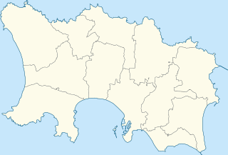
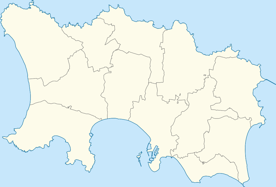
Français : Carte des
paroisses de Jersey au 1er janvier 2019. English: Map of the
parishes of Jersey on 1st January 2019. |
||||||||||||||||||||||||||||||||||||
| Date | |||||||||||||||||||||||||||||||||||||
| Source | Own work | ||||||||||||||||||||||||||||||||||||
| Author | Pymouss | ||||||||||||||||||||||||||||||||||||
| Permission ( Reusing this file) |
Based on OpenStreetMap, licensed under the Open Data Commons Open Database License. | ||||||||||||||||||||||||||||||||||||
| Other versions |
|
||||||||||||||||||||||||||||||||||||
Licensing
I, the copyright holder of this work, hereby publish it under the following license:
This file is licensed under the
Creative Commons
Attribution-Share Alike 4.0 International license.
- You are free:
- to share – to copy, distribute and transmit the work
- to remix – to adapt the work
- Under the following conditions:
- attribution – You must give appropriate credit, provide a link to the license, and indicate if changes were made. You may do so in any reasonable manner, but not in any way that suggests the licensor endorses you or your use.
- share alike – If you remix, transform, or build upon the material, you must distribute your contributions under the same or compatible license as the original.
File history
Click on a date/time to view the file as it appeared at that time.
| Date/Time | Thumbnail | Dimensions | User | Comment | |
|---|---|---|---|---|---|
| current | 20:11, 27 January 2019 |
| 959 × 650 (122 KB) | Pymouss | {{Information |Description={{fr|1=Carte des fr:paroisses de Jersey au 1{{er}} janvier 2019.}}{{en|1=Map of the en:parishes of Jersey on 1{{st}} January 2019.}} |Source={{own}} |Date=2019-01-27 |Author= Pymouss |Permission= |other_versions={{SVG locator maps (location map scheme)}} |permission=Based on [https://www.openstreetmap.org OpenStreetMap], licensed under the [https://opendatacommons.org/licenses/odbl/ Open Data Commons Open Database License]. }} [[Categor... |
File usage
The following pages on the English Wikipedia use this file (pages on other projects are not listed):
Global file usage
The following other wikis use this file:
- Usage on fr.wikipedia.org
- Usage on it.wikipedia.org
- Usage on www.wikidata.org