This article is about the continent near Maritime Southeast Asia. For the continental mainland, see
mainland Australia. For the prehistoric landmass, see
Sahul.
The continent includes a
continental shelf overlain by shallow seas which divide it into several landmasses—the
Arafura Sea and
Torres Strait between mainland Australia and New Guinea, and
Bass Strait between mainland Australia and Tasmania. When
sea levels were lower during the
Pleistocene ice age, including the
Last Glacial Maximum about 18,000 BC, they were connected by dry land into the combined landmass of
Sahul. The name "Sahul" derives from the
Sahul Shelf, which is a part of the continental shelf of the Australian continent. During the past 18,000 to 10,000 years, rising sea levels overflowed the lowlands and separated the continent into today's low-lying
arid to
semi-arid mainland and the two mountainous islands of New Guinea and Tasmania.
With a total land area of 8.56 million square kilometres (3,310,000 sq mi), the Australian continent is the smallest, lowest, flattest, and second-driest continent (after
Antarctica) on
Earth.[5] As the country of Australia is mostly on a single landmass, and comprises most of the continent, it is sometimes informally referred to as an island continent, surrounded by oceans.[6]
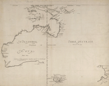
Mainland Australia showing the continental
Sahul Shelf (light blue) extending to the islands of New Guinea in the north, the island of Timor in the northwest, and Tasmania in the south
The continent of Australia is sometimes known by the names Sahul, Australinea, or Meganesia to differentiate it from the country of Australia, and consists of the landmasses which sit on Australia's continental plate. This includes
mainland Australia,
Tasmania, and the island of
New Guinea, which comprises
Papua New Guinea and
Western New Guinea (Papua and West Papua, provinces of
Indonesia).[15][16][17][18] The name "Sahul" takes its name from the
Sahul Shelf, which is part of the continental shelf of the Australian continent.
The term
Oceania, originally a "great division" of the world in the 1810s, was replaced in
English language countries by the concept of Australia as one of the world's continents in the 1950s.[19] Prior to the 1950s, before the popularization of the theory of
plate tectonics,
Antarctica, Australia and
Greenland were sometimes described as island continents, but none were usually taught as one of the world's continents in English-speaking countries.[20][21][19] Scottish
cartographerJohn Bartholomew wrote in 1873 that, "the
New World consists of
North America, and the peninsula of
South America attached to it. These divisions [are] generally themselves spoken as continents, and to them has been added another, embracing the large island of Australia and numerous others in the [Pacific] Ocean, under the name of Oceania. There are thus six great divisions of the earth —
Europe,
Asia,
Africa, North America, South America and Oceania."[22]
The American author
Samuel Griswold Goodrich wrote in his 1854 book History of All Nations that, "geographers have agreed to consider the island world of the Pacific Ocean as a third continent, under the name Oceania." In this book the other two continents were categorized as being the New World (consisting of North America and South America) and the
Old World (consisting of Africa, Asia and Europe).[23] In his 1879 book Australasia, British naturalist
Alfred Russel Wallace commented that, "Oceania is the word often used by continental geographers to describe the great world of islands we are now entering upon" and that "Australia forms its central and most important feature."[24] He did not explicitly label Oceania a continent in the book, but did note that it was one of the six major divisions of the world.[24] He considered it to encompass the insular Pacific area between Asia and the Americas, and claimed it extended up to the
Aleutian Islands, which are among the northernmost islands in the Pacific Ocean.[24] However, definitions of Oceania varied during the 19th century. In the 19th century, many geographers divided up Oceania into mostly racially-based subdivisions; Australasia, Malaysia (encompassing the
Malay Archipelago), Melanesia, Micronesia and Polynesia.[25]
The island states of
Indonesia,
Japan, the
Philippines,
Singapore and
Taiwan, all located within the bounds of the Pacific or associated
marginal seas, are excluded from the UN definition. The states of
Hong Kong and
Malaysia, located in both mainland Asia and marginal seas of the Pacific, are also excluded, as is the nation of
Brunei, which shares the island of
Borneo with Indonesia and Malaysia. Further excluded are
East Timor and
Indonesian New Guinea/Western New Guinea, areas which are biogeographically or geologically associated with the Australian landmass.[30] This definition of Oceania is used in statistical reports, by the
International Olympic Committee, and by many atlases.[31]The CIA World Factbook also categorize Oceania or the Pacific area as one of the world's major continental divisions, but use the term "Australia and Oceania" to refer to the area.[32] Their definition does not include Australia's subantarctic external territory
Heard Island and McDonald Islands, but is otherwise the same as the UN definition, and it is also used for statistical purposes.
In countries such as
Argentina,
Brazil,
China,
Chile,
Costa Rica,
Ecuador,
France,
Greece,
Italy,
Mexico, the
Netherlands,
Peru,
Spain,
Switzerland or
Venezuela, Oceania is treated as a continent in the sense that it is "one of the parts of the world", and Australia is only seen as an island nation. In other countries, including
Kazakhstan,
Norway,
Poland and
Russia, Australia and
Eurasia are thought of as continents, while Asia, Europe and Oceania are regarded as "parts of the world".[33] In the Pacific Ocean Handbook (1945), author Eliot Grinnell Mears wrote that he categorized Australia, New Zealand and Pacific islands under the label of Oceania for "scientific reasons; Australia's fauna is largely continental in character, New Zealand's are clearly insular; and neither
Commonwealth realm has close ties with Asia." He further added that, "the term Australasia is not relished by
New Zealanders and this name is too often confused with Australia."[34] Some 19th century definitions of Oceania grouped Australia, New Zealand and the islands of Melanesia together under the label of Australasia, in other 19th century definitions of Oceania, the term was only used to refer to Australia itself, with New Zealand being categorized with the islands of Polynesia in such definitions.[35][25]
Archaeological terminology for this region has changed repeatedly. Before the 1970s, the single Pleistocene landmass was called Australasia, derived from the
Latinaustralis, meaning "southern", although this word is most often used for a wider region that includes lands like New Zealand that are not on the same continental shelf. In the early 1970s, the term Greater Australia was introduced for the Pleistocene continent.[36] Then at a 1975 conference and consequent publication,[37] the name Sahul was extended from its previous use for just the
Sahul Shelf to cover the continent.[36]
In 1984 W. Filewood suggested the name Meganesia, meaning "great island" or "great island-group", for both the Pleistocene continent and the present-day lands,[38] and this name has been widely accepted by biologists.[39] Others have used Meganesia with different meanings: travel writer
Paul Theroux included New Zealand in his definition[40] and others have used it for Australia, New Zealand and
Hawaii.[41] Another biologist,
Richard Dawkins, coined the name Australinea in 2004.[42]Australia–New Guinea has also been used.[43]
The Australian continent, being a part of the
Indo-Australian Plate (more specifically, the
Australian Plate), is the lowest, flattest, and oldest landmass on Earth[44] and it has had a relatively stable geological history.
New Zealand is not part of the continent of Australia, but of the separate, submerged continent of
Zealandia.[45] New Zealand and Australia are both part of the Oceanian sub-region known as
Australasia, with New Guinea being in
Melanesia.
The continent includes a continental shelf overlain by shallow seas which divide it into several landmasses—the
Arafura Sea and
Torres Strait between mainland Australia and New Guinea, and
Bass Strait between mainland Australia and Tasmania. When
sea levels were lower during the
Pleistocene ice age, including the
Last Glacial Maximum about 18,000 BC, they were connected by dry land. During the past 18,000[46] to 10,000 years, rising sea levels overflowed the lowlands and separated the continent into today's low-lying
arid to
semi-arid mainland and the two mountainous islands of New Guinea and Tasmania.[47] The
continental shelf connecting the islands, half of which is less than 50 metres (160 ft) deep, covers some 2.5 million square kilometres (970,000 sq mi), including the
Sahul Shelf[48][49] and
Bass Strait.
Geological forces such as
tectonic uplift of mountain ranges or clashes between tectonic plates occurred mainly in Australia's early history, when it was still a part of
Gondwana. Australia is situated in the middle of the tectonic plate, and therefore currently has no active volcanism.[50]
The continent primarily sits on the Indo-Australian Plate. Because of its central location on its tectonic plate, Australia does not have any active volcanic regions, the only continent with this distinction.[51] The lands were joined with
Antarctica as part of the southern supercontinent
Gondwana until the plate began to drift north about 96 million years ago. For most of the time since then, Australia–New Guinea remained a continuous landmass. When the
last glacial period ended in about 10,000 BC, rising sea levels formed
Bass Strait, separating Tasmania from the mainland. Then between about 8,000 and 6,500 BC, the lowlands in the north were flooded by the sea, separating the
Aru Islands, mainland Australia,
New Guinea, and Tasmania.
The Australian continent and
Sunda were points of early human migrations after leaving Africa.[54]
Recent research points to a planned migration of hundreds of people using bamboo rafts, which eventually landed on Sahul.[55][56][57]
Indigenous Australians, that is
Aboriginal Australians and
Torres Strait Islanders people, are the original inhabitants of the Australian continent and nearby islands. They migrated from Africa to Asia around 70,000 years ago[58] and arrived in Australia at least 50,000 years ago, based on archaeological evidence.[59] More recent research points to earlier arrival, possibly 65,000 years ago.[60]
They are believed to be among the
earliest human migrations out of Africa. There is evidence of genetic and linguistic interchange between Australians in the far north and the Austronesian peoples of modern-day
New Guinea and the islands, but this may be the result of recent trade and
intermarriage.[61] The
earliest known human remains were found at
Lake Mungo, a dry lake in the southwest of New South Wales.[62] Remains found at Mungo suggest one of the world's oldest known
cremations, thus indicating early evidence for religious ritual among humans.[63]Dreamtime remains a prominent feature of
Australian Aboriginal art, the oldest continuing tradition of art in the world.[64]
Papuan habitation is estimated to have begun between 42,000 and 48,000 years ago in New Guinea.[65] Trade between New Guinea and neighboring Indonesian islands was documented as early as the seventh century, and archipelagic rule of New Guinea by the 13th. At the beginning of the seventh century, the
Sumatra-based empire of
Srivijaya (7th century–13th century) engaged in trade relations with western New Guinea, initially taking items like
sandalwood and
birds-of-paradise in
tribute to China, but later making slaves out of the natives.[66] The rule of the
Java-based empire of
Majapahit (1293–1527) extended to the western fringes of New Guinea.[67] Recent archaeological research suggests that 50,000 years ago people may have occupied sites in the highlands at New Guinean altitudes of up to 2,000 m (6,600 ft), rather than being restricted to warmer coastal areas.[68]
Pre-colonial history
Terra Australis, as it appears on a map by
Rumold Mercator, 1587
Legends of Terra Australis Incognita—an "unknown land of the South"—date back to Roman times and before, and were commonplace in medieval geography, although not based on any documented knowledge of the continent.[69] Ancient Greek philosopher
Aristotle speculated of a large landmass in the southern hemisphere, saying, "Now since there must be a region bearing the same relation to the southern pole as the place we live in bears to our pole...".[70] His ideas were later expanded by
Ptolemy (2nd century AD), who believed that the lands of the
Northern Hemisphere should be balanced by land in the
south. The theory of balancing land has been documented as early as the 5th century on maps by
Macrobius, who uses the term Australis on his maps.[71]
Terra Australis, a hypothetical
continent first posited in
antiquity, appeared on maps between the 15th and 18th centuries.[72] Scientists, such as
Gerardus Mercator (1569)[73] and
Alexander Dalrymple as late as 1767 argued for its existence, with such arguments as that there should be a large
landmass in the
south as a
counterweight to the known landmasses in the Northern Hemisphere.[74] The cartographic depictions of the southern continent in the 16th and early 17th centuries, as might be expected for a concept based on such abundant conjecture and minimal data, varied wildly from map to map; in general, the continent shrank as potential locations were reinterpreted. At its largest, the continent included
Tierra del Fuego, separated from South America by a small strait;
New Guinea; and what would come to be called Australia.[75]
In the quest for
Terra Australis, Spanish explorations in the 17th century, such as the expedition led by the Portuguese navigator
Pedro Fernandes de Queirós, discovered the
Pitcairn and
Vanuatu archipelagos, and sailed the
Torres Strait between
Australia and
New Guinea, named after navigator
Luís Vaz de Torres, who was the first European to explore the Strait. When
Europeans first arrived, inhabitants of New Guinea and nearby islands, whose technologies included bone, wood, and stone tools, had a productive agricultural system. In 1660, the Dutch recognised the Sultan of
Tidore's sovereignty over
New Guinea. The first known Europeans to sight New Guinea were probably the
Portuguese and
Spanish navigators sailing in the South Pacific in the early part of the 16th century.
On 23 April 1770 British explorer
James Cook made his first recorded direct observation of
indigenous Australians at
Brush Island near
Bawley Point.[79] On 29 April, Cook and crew made their first landfall on the mainland of the continent at a place now known as the
Kurnell Peninsula. It is here that James Cook made first contact with an Aboriginal tribe known as the
Gweagal, who he fired upon, injuring one.[80] His expedition became the first recorded Europeans to have encountered the eastern coastline of Australia.[81] Captain
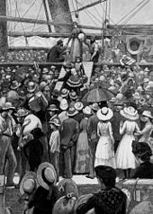
Arthur Phillip led the First Fleet of 11 ships and about 850 convicts into
Sydney on 26 January 1788.[82] This was to be the location for the new colony. Phillip described
Sydney Cove as being "without exception the finest harbour in the world".[83]
In 1883, the
Colony of Queensland tried to annex the southern half of eastern New Guinea, but the British government did not approve.[84] The
Commonwealth of Australia came into being when the
Federal Constitution was proclaimed by the
Governor-General,
Lord Hopetoun, on 1 January 1901. From that point a system of
federalism in Australia came into operation, entailing the establishment of an entirely new national government (the Commonwealth government) and an ongoing division of powers between that government and the States. With the encouragement of Queensland, in 1884, a
British protectorate had been proclaimed over the southern coast of New Guinea and its adjacent islands.
British New Guinea was annexed outright in 1888. The possession was placed under the authority of the newly federated Commonwealth of Australia in 1902 and with passage of the Papua Act of 1905, British New Guinea became the Australian
Territory of Papua, with formal Australian administration beginning in 1906.[85]
An Australian light machine gun team in action near
Wewak,
Papua New Guinea, in June 1945
The
Bombing of Darwin on 19 February 1942 was the largest single attack ever mounted by a foreign power on Australia.[86] In an effort to isolate Australia, the Japanese planned a seaborne invasion of
Port Moresby, in the Australian
Territory of New Guinea. Between July and November 1942, Australian forces repulsed Japanese attempts on the city by way of the
Kokoda Track, in the highlands of
New Guinea. The
Battle of Buna–Gona, between November 1942 and January 1943, set the tone for the bitter final stages of the
New Guinea campaign, which persisted into 1945. The offensives in Papua and New Guinea of 1943–44 were the single largest series of connected operations ever mounted by the Australian armed forces.[87]
Following the 1998 commencement of
reforms across Indonesia, Papua and other Indonesian provinces received greater regional autonomy. In 2001, "Special Autonomy" status was granted to Papua province, although to date, implementation has been partial and often criticised.[88] The region was administered as a single province until 2003, when it was split into the provinces of
Papua and
West Papua. Elections in 1972 resulted in the formation of a ministry headed by Chief Minister
Michael Somare, who pledged to lead the country to self-government and then to independence. Papua New Guinea became self-governing on 1 December 1973 and achieved independence on 16 September 1975. The country joined the
United Nations (UN) on 10 October 1975.[89]
Migration brought large numbers of southern and central Europeans to Australia for the first time. A 1958 government leaflet assured readers that unskilled non-British migrants were needed for "labour on rugged projects ...work which is not generally acceptable to Australians or British workers".[90] Australia fought on the side of Britain in the two
world wars and became a long-standing
ally of the United States when threatened by
Imperial Japan during
World War II. Trade with Asia increased and a post-war immigration program received more than 6.5 million migrants from every continent. Supported by immigration of people from more than 200 countries since the end of World War II, the population increased to more than 23 million by 2014.[91]
For about 40 million years Australia–New Guinea was almost completely isolated. During this time, the continent experienced numerous changes in climate, but the overall trend was towards greater aridity. When
South America eventually separated from Antarctica, the development of the cold
Antarctic Circumpolar Current changed weather patterns across the world. For Australia–New Guinea, it brought a marked intensification of the drying trend. The great inland seas and lakes dried out. Much of the long-established broad-leaf
deciduous forest began to give way to the distinctive hard-leaved
sclerophyllous plants that characterise the modern Australian landscape.
For many species, the primary refuge was the relatively cool and well-watered
Great Dividing Range. Even today, pockets of remnant vegetation remain in the cool uplands, some species not much changed from the Gondwanan forms of 60 or 90 million years ago. Eventually, the Australia–New Guinea tectonic plate collided with the
Eurasian plate to the north. The collision caused the northern part of the continent to buckle upwards, forming the high and rugged mountains of New Guinea and, by reverse (downwards) buckling, the
Torres Strait that now separates the two main landmasses. The collision also pushed up the islands of
Wallacea, which served as island 'stepping-stones' that allowed plants from
Southeast Asia's rainforests to colonise New Guinea, and some plants from Australia–New Guinea to move into Southeast Asia. The ocean straits between the islands were narrow enough to allow plant dispersal, but served as an effective barrier to exchange of land mammals between Australia–New Guinea and Asia.
Among the fungi, the remarkable association between Cyttariagunnii (one of the "golf-ball" fungi) and its associated trees in the genus Nothofagus is evidence of that drift: the only other places where this association is known are New Zealand and southern
Argentina and
Chile.[93]
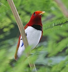
The king bird-of-paradise is one of over 300 bird species in West Papua.
Due to the spread of animals, fungi and plants across the single Pleistocene landmass the separate lands have a related
biota.[94] There are over 300 bird species in
West Papua, of which at least 20 are unique to the ecoregion, and some live only in very restricted areas. These include the
grey-banded munia,
Vogelkop bowerbird, and the
king bird-of-paradise.[95]
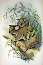
Natural history illustrator John Gould popularised the koala with his 1863 work The Mammals of Australia.
As the continent drifted north from Antarctica, a unique
fauna,
flora and
mycobiota developed.
Marsupials and
monotremes also existed on other continents, but only in Australia–New Guinea did they out-compete the
placentalmammals and come to dominate. New Guinea has 284 species and six orders of mammals: monotremes, three orders of marsupials,
rodents and
bats; 195 of the mammal species (69%) are endemic. New Guinea has a rich diversity of
coral life and 1,200 species of
fish have been found. Also about 600 species of reef-building coral—the latter equal to 75 percent of the world's known total. New Guinea has 578 species of breeding birds, of which 324 species are endemic.
Bird life also flourished—in particular, the
songbirds (order
Passeriformes, suborder Passeri) are thought to have evolved 50 million years ago in the part of
Gondwana that later became
Australia, New Zealand,
New Guinea, and
Antarctica, before radiating into a great number of different forms and then spreading around the globe.[103]
Animal groups such as
macropods,
monotremes, and
cassowaries are endemic to Australia. There were three main reasons for the enormous diversity that developed in animal, fungal and plant life.
While much of the rest of the world underwent significant cooling and thus loss of species diversity, Australia–New Guinea was drifting north at such a pace that the overall global cooling effect was roughly equalled by its gradual movement toward the
equator.
Temperatures in Australia–New Guinea, in other words, remained reasonably constant for a very long time, and a vast number of different animal, fungal and plant species were able to evolve to fit particular
ecological niches.
Because the continent was more isolated than any other, very few outside species arrived to colonise, and unique native forms developed unimpeded.
Finally, despite the fact that the continent was already very old and thus relatively infertile, there are dispersed areas of high fertility. Where other continents had
volcanic activity and/or massive
glaciation events to turn over fresh, unleached
rocks rich in
minerals, the rocks and
soils of Australia–New Guinea were left largely untouched except by gradual
erosion and deep
weathering. In general, fertile soils produce a profusion of life, and a relatively large number of species/level of biodiversity. This is because where
nutrients are plentiful, competition is largely a matter of outcompeting rival species, leaving great scope for innovative
co-evolution as is witnessed in tropical, fertile ecosystems. In contrast, infertile soils tend to induce competition on an abiotic basis meaning individuals all face constant environmental pressures, leaving less scope for divergent evolution, a process instrumental in creating new species.
Although New Guinea is the most northerly part of the continent, and could be expected to be the most
tropical in climate, the altitude of the New Guinea highlands is such that a great many animals and plants that were once common across Australia–New Guinea now survive only in the tropical highlands where they are severely threatened by
population growth.
In New Guinea, the climate is mostly
monsoonal (December to March), southeast monsoon (May to October), and
tropical rainforest with slight seasonal temperature variation. In lower altitudes, the temperature is around 27 °C (81 °F) year round. But the higher altitudes, such as
Mendi, are constantly around 21 °C (70 °F) with cool lows nearing 11 °C (52 °F), with abundant rainfall and high humidity. The
New Guinea Highlands are one of the few regions close to the
equator that experience
snowfall, which occurs in the most elevated parts of the mainland. Some areas in the island experience an extraordinary amount of precipitation, averaging roughly 4,500 millimetres (180 in) of rainfall annually.
Since 1945, more than 7 million people have settled in Australia. From the late 1970s, there was a significant increase in immigration from Asian and other non-European countries, making Australia a
multicultural country.[113] Sydney is the most
multicultural city in Oceania, having more than 250 different languages spoken, with about 40 percent of residents speaking a
language other than English at home.[114] Furthermore, 36 percent of the population reported having been
born overseas, with top countries being
Italy,
Lebanon,
Vietnam and
Iraq, among others.[115][116]Melbourne is also fairly multicultural, having the largest
Greek-speaking population outside of
Europe,[117] and the second largest
Asian population in Australia after Sydney.[118][119][120]
Papua New Guinea is rich in natural resources, which account for two-thirds of their export earnings. Though PNG is filled with resources, the lack of country's development led foreign countries to take over few sites and continued foreign demand for PNG's resources and as a result, the United States constructed an oil company and began to export in 2004 and this was the largest project in PNG's history.[136][137] Papua New Guinea is classified as a
developing economy by the
International Monetary Fund.[138] Strong growth in
Papua New Guinea's mining and resource sector led to the country becoming the sixth
fastest-growing economy in the world in 2011.[139][140]
Papua New Guinea is a
Commonwealth realm. As such, King
Charles III is its sovereign and head of state. The constitutional convention, which prepared the draft constitution, and Australia, the outgoing metropolitan power, had thought that Papua New Guinea would not remain a monarchy. The founders, however, considered that imperial honours had a cachet.[147] The monarch is represented by the
Governor-General of Papua New Guinea, currently
Bob Dadae. Papua New Guinea (along with
Solomon Islands) is unusual among Commonwealth realms in that governors-general are elected by the legislature, rather than chosen by the executive branch.
It is estimated that more than 7000 different cultural groups exist in Papua New Guinea, and most groups have their own language. Because of this diversity, in which they take pride, many different styles of cultural expression have emerged; each group has created its own expressive forms in
art,
performance art,
weaponry,
costumes and
architecture. Papua New Guinea is one of the few cultures in Oceania to practice the tradition of
bride price.[160] In particular, Papua New Guinea is world-famous for carved wooden
sculpture: masks, canoes, story-boards.
Australia has a tradition of Aboriginal art which is thousands of years old, the best known forms being rock art and
bark painting. Evidence of
Aboriginal art in Australia can be traced back at least 30,000 years.[161] Examples of ancient Aboriginal rock artworks can be found throughout the continent – notably in national parks such as those of the
UNESCO listed sites at
Uluru and
Kakadu National Park in the Northern Territory, but also within
protected parks in urban areas such as at
Ku-ring-gai Chase National Park in Sydney.[162][163] Aboriginal culture includes a number of practices and ceremonies centered on a belief in the
Dreamtime. Reverence for the land and oral traditions are emphasised.[164]
^United Nations, Department of Economic and Social Affairs, Population Division, (2019). 'International Migration' in International migrant stock
2019. Accessed from
International migrant stock 2015: maps on 24 May 2017.
^
abLewis & Wigen, The Myth of Continents (1997), p. 32: "...the 1950s... was also the period when... Oceania as a "great division" was replaced by Australia as a continent along with a series of isolated and continentally attached islands. [Footnote 78: When Southeast Asia was conceptualised as a world region during World War II..., Indonesia and the Philippines were perforce added to Asia, which reduced the extent of Oceania, leading to a reconceptualisation of Australia as a continent in its own right. This manoeuvre is apparent in postwar atlases]"
^Goodrich, Samuel Griswold (1854).
History of All Nations. Miller, Orton and Mulligan. Retrieved 20 December 2022.
^
abcWallace, Alfred Russel (1879).
Australasia. The University of Michigan. p. 2.
Archived from the original on 30 July 2022. Retrieved 12 March 2022. Oceania is the word often used by continental geographers to describe the great world of islands we are now entering upon [...] This boundless watery domain, which extends northwards of Behring Straits and southward to the Antarctic barrier of ice, is studded with many island groups, which are, however, very irregularly distributed over its surface. The more northerly section, lying between Japan and California and between the Aleutian and Hawaiian Archipelagos is relived by nothing but a few solitary reefs and rocks at enormously distant intervals.
^Hillstrom, Kevin; Hillstrom, Laurie Collier (2003). Australia, Oceania, and Antarctica: A Continental Overview of Environmental Issues. Vol. 3. ABC-CLIO. p. 25.
ISBN9781576076941. ...defined here as the continent nation of Australia, New Zealand, and twenty-two other island countries and territories sprinkled over more than 40 million square kilometres of the South Pacific.
^Lewis, Martin W.; Kären E. Wigen (1997). The Myth of Continents: a Critique of Metageography. Berkeley: University of California Press. p.
32.
ISBN978-0-520-20742-4. Interestingly enough, the answer [from a scholar who sought to calculate the number of continents] conformed almost precisely to the conventional list: North America, South America, Europe, Asia, Oceania (Australia plus New Zealand), Africa, and Antarctica.
^
abBallard, Chris (1993). "Stimulating minds to fantasy? A critical etymology for Sahul". Sahul in review: Pleistocene archaeology in Australia, New Guinea and island Melanesia. Canberra: Australian National University. pp. 19–20.
ISBN0-7315-1540-4.
^Filewood, W. (1984). "The Torres connection: Zoogeography of New Guinea". Vertebrate zoogeography in Australasia. Carlisle, W.A.: Hesperian Press. pp. 1124–1125.
ISBN0-85905-036-X.
^Pain, C.F., Villans, B.J., Roach, I.C., Worrall, L. & Wilford, J.R. (2012): Old, flat and red – Australia's distinctive landscape. In: Shaping a Nation: A Geology of Australia. Blewitt, R.S. (Ed.) Geoscience Australia and ANU E Press, Canberra. Pp. 227–275
ISBN978-1-922103-43-7
^Wirantaprawira, Dr Willy (2003).
"Republik Indonesia". Dr Willy Wirantaprawira.
Archived from the original on 18 October 2006. Retrieved 28 August 2006.
^Audley-Charles, M. G. (1986). "Timor–Tanimbar Trough: the foreland basin of the evolving Banda orogen". Spec. Publs Int. Ass. Sediment. 8: 91–102.
doi:
10.1002/9781444303810.ch5.
ISBN9781444303810.
^Bowler J.M.; Johnston H.; Olley J.M.; Prescott J.R.; Roberts R.G.; Shawcross W.; Spooner N.A. (2003). "New ages for human occupation and climatic change at Lake Mungo, Australia". Nature. 421 (6925): 837–40.
Bibcode:
2003Natur.421..837B.
doi:
10.1038/nature01383.
PMID12594511.
S2CID4365526.
^Bowler, J. M. (1971). "Pleistocene salinities and climatic change: Evidence from lakes and lunettes in southeastern Australia". In Mulvaney, D. J.; Golson, J. (eds.). Aboriginal Man and Environment in Australia. Canberra: Australian National University Press. pp. 47–65.
ISBN0-7081-0452-5.
^"The Indigenous Collection". The Ian Potter Centre: NGV Australia. National Gallery of Victoria. Archived from
the original on 7 October 2010. Retrieved 6 December 2010.
^Albert-Marie-Ferdinand Anthiaume, "Un pilote et cartographe havrais au XVIe siècle: Guillaume Le Testu", Bulletin de Géographie Historique et Descriptive, Paris, Nos 1–2, 1911, pp. 135–202, n.b. p. 176.
^John Noble Wilford: The Mapmakers, the Story of the Great Pioneers in Cartography from Antiquity to Space Age, p. 139, Vintage Books, Random House 1982,
ISBN0-394-75303-8
^Carlos Pedro Vairo, TERRA AUSTRALIS Historical Charts of Patagonia, Tierra del Fuego and Antarctica. Ed. Zagier & Urruty Publicationa, 2010.
^Spieghel der Australische Navigatie; cited by A. Lodewyckx, "The Name of Australia: Its Origin and Early Use", The Victorian Historical Magazine, Vol. XIII, No. 3, June 1929, pp. 100–191.
^J.P. Sigmond and L.H. Zuiderbaan (1979) Dutch Discoveries of Australia.Rigby Ltd, Australia. pp. 19–30
ISBN0-7270-0800-5
^Korf, R. P. (1983). "Cyttaria (Cyttariales): coevolution with Nothofagus, and evolutionary relationship to the Boedijnpezizeae (Pezizales, Sarcoscyphaceae)". In Pirozynski, K. A.; Walker, J. (eds.). Pacific Mycogeography: a Preliminary Approach. Australian Journal of Botany Supplementary Series. Vol. 10. pp. 77–87.
ISBN0-643-03548-6.
^"Cultural diversity in Australia". 2071.0 – Reflecting a Nation: Stories from the 2011 Census, 2012–2013. Australian Bureau of Statistics. 21 June 2012. Archived from
the original on 25 April 2016. Retrieved 27 June 2012.
^Statistics, c=AU; o=Commonwealth of Australia; ou=Australian Bureau of.
"Main Features – Net Overseas Migration". www.abs.gov.au. Archived from
the original on 10 October 2017. Retrieved 10 February 2018.{{
cite web}}: CS1 maint: multiple names: authors list (
link)
^"Global Power City Index 2010"(PDF). Tokyo, Japan: Institute for Urban Strategies at The Mori Memorial Foundation. October 2010. Retrieved 10 August 2011.
^Fenna, Alan; Robbins, Jane; Summers, John (2013). Government Politics in Australia. London, United Kingdom: Pearson Higher Education AU. p. 139.
ISBN978-1-4860-0138-5.
^"Australian Indigenous art". Australian Culture and Recreation Portal. Australia Government. 21 December 2007. Archived from
the original on 16 April 2010. Retrieved 26 September 2010.
^"PNG vow to upset World Cup odds". Rugby League. BBC. 15 October 2008. Retrieved 3 July 2009. But it would still be one of the biggest shocks in
World Cup history if Papua New Guinea – the only country to have Rugby League as its national Sport – were to qualify for the last 4.
This article is about the continent near Maritime Southeast Asia. For the continental mainland, see
mainland Australia. For the prehistoric landmass, see
Sahul.
The continent includes a
continental shelf overlain by shallow seas which divide it into several landmasses—the
Arafura Sea and
Torres Strait between mainland Australia and New Guinea, and
Bass Strait between mainland Australia and Tasmania. When
sea levels were lower during the
Pleistocene ice age, including the
Last Glacial Maximum about 18,000 BC, they were connected by dry land into the combined landmass of
Sahul. The name "Sahul" derives from the
Sahul Shelf, which is a part of the continental shelf of the Australian continent. During the past 18,000 to 10,000 years, rising sea levels overflowed the lowlands and separated the continent into today's low-lying
arid to
semi-arid mainland and the two mountainous islands of New Guinea and Tasmania.
With a total land area of 8.56 million square kilometres (3,310,000 sq mi), the Australian continent is the smallest, lowest, flattest, and second-driest continent (after
Antarctica) on
Earth.[5] As the country of Australia is mostly on a single landmass, and comprises most of the continent, it is sometimes informally referred to as an island continent, surrounded by oceans.[6]
Mainland Australia showing the continental
Sahul Shelf (light blue) extending to the islands of New Guinea in the north, the island of Timor in the northwest, and Tasmania in the south
The continent of Australia is sometimes known by the names Sahul, Australinea, or Meganesia to differentiate it from the country of Australia, and consists of the landmasses which sit on Australia's continental plate. This includes
mainland Australia,
Tasmania, and the island of
New Guinea, which comprises
Papua New Guinea and
Western New Guinea (Papua and West Papua, provinces of
Indonesia).[15][16][17][18] The name "Sahul" takes its name from the
Sahul Shelf, which is part of the continental shelf of the Australian continent.
The term
Oceania, originally a "great division" of the world in the 1810s, was replaced in
English language countries by the concept of Australia as one of the world's continents in the 1950s.[19] Prior to the 1950s, before the popularization of the theory of
plate tectonics,
Antarctica, Australia and
Greenland were sometimes described as island continents, but none were usually taught as one of the world's continents in English-speaking countries.[20][21][19] Scottish
cartographerJohn Bartholomew wrote in 1873 that, "the
New World consists of
North America, and the peninsula of
South America attached to it. These divisions [are] generally themselves spoken as continents, and to them has been added another, embracing the large island of Australia and numerous others in the [Pacific] Ocean, under the name of Oceania. There are thus six great divisions of the earth —
Europe,
Asia,
Africa, North America, South America and Oceania."[22]
The American author
Samuel Griswold Goodrich wrote in his 1854 book History of All Nations that, "geographers have agreed to consider the island world of the Pacific Ocean as a third continent, under the name Oceania." In this book the other two continents were categorized as being the New World (consisting of North America and South America) and the
Old World (consisting of Africa, Asia and Europe).[23] In his 1879 book Australasia, British naturalist
Alfred Russel Wallace commented that, "Oceania is the word often used by continental geographers to describe the great world of islands we are now entering upon" and that "Australia forms its central and most important feature."[24] He did not explicitly label Oceania a continent in the book, but did note that it was one of the six major divisions of the world.[24] He considered it to encompass the insular Pacific area between Asia and the Americas, and claimed it extended up to the
Aleutian Islands, which are among the northernmost islands in the Pacific Ocean.[24] However, definitions of Oceania varied during the 19th century. In the 19th century, many geographers divided up Oceania into mostly racially-based subdivisions; Australasia, Malaysia (encompassing the
Malay Archipelago), Melanesia, Micronesia and Polynesia.[25]
The island states of
Indonesia,
Japan, the
Philippines,
Singapore and
Taiwan, all located within the bounds of the Pacific or associated
marginal seas, are excluded from the UN definition. The states of
Hong Kong and
Malaysia, located in both mainland Asia and marginal seas of the Pacific, are also excluded, as is the nation of
Brunei, which shares the island of
Borneo with Indonesia and Malaysia. Further excluded are
East Timor and
Indonesian New Guinea/Western New Guinea, areas which are biogeographically or geologically associated with the Australian landmass.[30] This definition of Oceania is used in statistical reports, by the
International Olympic Committee, and by many atlases.[31]The CIA World Factbook also categorize Oceania or the Pacific area as one of the world's major continental divisions, but use the term "Australia and Oceania" to refer to the area.[32] Their definition does not include Australia's subantarctic external territory
Heard Island and McDonald Islands, but is otherwise the same as the UN definition, and it is also used for statistical purposes.
In countries such as
Argentina,
Brazil,
China,
Chile,
Costa Rica,
Ecuador,
France,
Greece,
Italy,
Mexico, the
Netherlands,
Peru,
Spain,
Switzerland or
Venezuela, Oceania is treated as a continent in the sense that it is "one of the parts of the world", and Australia is only seen as an island nation. In other countries, including
Kazakhstan,
Norway,
Poland and
Russia, Australia and
Eurasia are thought of as continents, while Asia, Europe and Oceania are regarded as "parts of the world".[33] In the Pacific Ocean Handbook (1945), author Eliot Grinnell Mears wrote that he categorized Australia, New Zealand and Pacific islands under the label of Oceania for "scientific reasons; Australia's fauna is largely continental in character, New Zealand's are clearly insular; and neither
Commonwealth realm has close ties with Asia." He further added that, "the term Australasia is not relished by
New Zealanders and this name is too often confused with Australia."[34] Some 19th century definitions of Oceania grouped Australia, New Zealand and the islands of Melanesia together under the label of Australasia, in other 19th century definitions of Oceania, the term was only used to refer to Australia itself, with New Zealand being categorized with the islands of Polynesia in such definitions.[35][25]
Archaeological terminology for this region has changed repeatedly. Before the 1970s, the single Pleistocene landmass was called Australasia, derived from the
Latinaustralis, meaning "southern", although this word is most often used for a wider region that includes lands like New Zealand that are not on the same continental shelf. In the early 1970s, the term Greater Australia was introduced for the Pleistocene continent.[36] Then at a 1975 conference and consequent publication,[37] the name Sahul was extended from its previous use for just the
Sahul Shelf to cover the continent.[36]
In 1984 W. Filewood suggested the name Meganesia, meaning "great island" or "great island-group", for both the Pleistocene continent and the present-day lands,[38] and this name has been widely accepted by biologists.[39] Others have used Meganesia with different meanings: travel writer
Paul Theroux included New Zealand in his definition[40] and others have used it for Australia, New Zealand and
Hawaii.[41] Another biologist,
Richard Dawkins, coined the name Australinea in 2004.[42]Australia–New Guinea has also been used.[43]
The Australian continent, being a part of the
Indo-Australian Plate (more specifically, the
Australian Plate), is the lowest, flattest, and oldest landmass on Earth[44] and it has had a relatively stable geological history.
New Zealand is not part of the continent of Australia, but of the separate, submerged continent of
Zealandia.[45] New Zealand and Australia are both part of the Oceanian sub-region known as
Australasia, with New Guinea being in
Melanesia.
The continent includes a continental shelf overlain by shallow seas which divide it into several landmasses—the
Arafura Sea and
Torres Strait between mainland Australia and New Guinea, and
Bass Strait between mainland Australia and Tasmania. When
sea levels were lower during the
Pleistocene ice age, including the
Last Glacial Maximum about 18,000 BC, they were connected by dry land. During the past 18,000[46] to 10,000 years, rising sea levels overflowed the lowlands and separated the continent into today's low-lying
arid to
semi-arid mainland and the two mountainous islands of New Guinea and Tasmania.[47] The
continental shelf connecting the islands, half of which is less than 50 metres (160 ft) deep, covers some 2.5 million square kilometres (970,000 sq mi), including the
Sahul Shelf[48][49] and
Bass Strait.
Geological forces such as
tectonic uplift of mountain ranges or clashes between tectonic plates occurred mainly in Australia's early history, when it was still a part of
Gondwana. Australia is situated in the middle of the tectonic plate, and therefore currently has no active volcanism.[50]
The continent primarily sits on the Indo-Australian Plate. Because of its central location on its tectonic plate, Australia does not have any active volcanic regions, the only continent with this distinction.[51] The lands were joined with
Antarctica as part of the southern supercontinent
Gondwana until the plate began to drift north about 96 million years ago. For most of the time since then, Australia–New Guinea remained a continuous landmass. When the
last glacial period ended in about 10,000 BC, rising sea levels formed
Bass Strait, separating Tasmania from the mainland. Then between about 8,000 and 6,500 BC, the lowlands in the north were flooded by the sea, separating the
Aru Islands, mainland Australia,
New Guinea, and Tasmania.
The Australian continent and
Sunda were points of early human migrations after leaving Africa.[54]
Recent research points to a planned migration of hundreds of people using bamboo rafts, which eventually landed on Sahul.[55][56][57]
Indigenous Australians, that is
Aboriginal Australians and
Torres Strait Islanders people, are the original inhabitants of the Australian continent and nearby islands. They migrated from Africa to Asia around 70,000 years ago[58] and arrived in Australia at least 50,000 years ago, based on archaeological evidence.[59] More recent research points to earlier arrival, possibly 65,000 years ago.[60]
They are believed to be among the
earliest human migrations out of Africa. There is evidence of genetic and linguistic interchange between Australians in the far north and the Austronesian peoples of modern-day
New Guinea and the islands, but this may be the result of recent trade and
intermarriage.[61] The
earliest known human remains were found at
Lake Mungo, a dry lake in the southwest of New South Wales.[62] Remains found at Mungo suggest one of the world's oldest known
cremations, thus indicating early evidence for religious ritual among humans.[63]Dreamtime remains a prominent feature of
Australian Aboriginal art, the oldest continuing tradition of art in the world.[64]
Papuan habitation is estimated to have begun between 42,000 and 48,000 years ago in New Guinea.[65] Trade between New Guinea and neighboring Indonesian islands was documented as early as the seventh century, and archipelagic rule of New Guinea by the 13th. At the beginning of the seventh century, the
Sumatra-based empire of
Srivijaya (7th century–13th century) engaged in trade relations with western New Guinea, initially taking items like
sandalwood and
birds-of-paradise in
tribute to China, but later making slaves out of the natives.[66] The rule of the
Java-based empire of
Majapahit (1293–1527) extended to the western fringes of New Guinea.[67] Recent archaeological research suggests that 50,000 years ago people may have occupied sites in the highlands at New Guinean altitudes of up to 2,000 m (6,600 ft), rather than being restricted to warmer coastal areas.[68]
Pre-colonial history
Terra Australis, as it appears on a map by
Rumold Mercator, 1587
Legends of Terra Australis Incognita—an "unknown land of the South"—date back to Roman times and before, and were commonplace in medieval geography, although not based on any documented knowledge of the continent.[69] Ancient Greek philosopher
Aristotle speculated of a large landmass in the southern hemisphere, saying, "Now since there must be a region bearing the same relation to the southern pole as the place we live in bears to our pole...".[70] His ideas were later expanded by
Ptolemy (2nd century AD), who believed that the lands of the
Northern Hemisphere should be balanced by land in the
south. The theory of balancing land has been documented as early as the 5th century on maps by
Macrobius, who uses the term Australis on his maps.[71]
Terra Australis, a hypothetical
continent first posited in
antiquity, appeared on maps between the 15th and 18th centuries.[72] Scientists, such as
Gerardus Mercator (1569)[73] and
Alexander Dalrymple as late as 1767 argued for its existence, with such arguments as that there should be a large
landmass in the
south as a
counterweight to the known landmasses in the Northern Hemisphere.[74] The cartographic depictions of the southern continent in the 16th and early 17th centuries, as might be expected for a concept based on such abundant conjecture and minimal data, varied wildly from map to map; in general, the continent shrank as potential locations were reinterpreted. At its largest, the continent included
Tierra del Fuego, separated from South America by a small strait;
New Guinea; and what would come to be called Australia.[75]
In the quest for
Terra Australis, Spanish explorations in the 17th century, such as the expedition led by the Portuguese navigator
Pedro Fernandes de Queirós, discovered the
Pitcairn and
Vanuatu archipelagos, and sailed the
Torres Strait between
Australia and
New Guinea, named after navigator
Luís Vaz de Torres, who was the first European to explore the Strait. When
Europeans first arrived, inhabitants of New Guinea and nearby islands, whose technologies included bone, wood, and stone tools, had a productive agricultural system. In 1660, the Dutch recognised the Sultan of
Tidore's sovereignty over
New Guinea. The first known Europeans to sight New Guinea were probably the
Portuguese and
Spanish navigators sailing in the South Pacific in the early part of the 16th century.
On 23 April 1770 British explorer
James Cook made his first recorded direct observation of
indigenous Australians at
Brush Island near
Bawley Point.[79] On 29 April, Cook and crew made their first landfall on the mainland of the continent at a place now known as the
Kurnell Peninsula. It is here that James Cook made first contact with an Aboriginal tribe known as the
Gweagal, who he fired upon, injuring one.[80] His expedition became the first recorded Europeans to have encountered the eastern coastline of Australia.[81] Captain
Arthur Phillip led the First Fleet of 11 ships and about 850 convicts into
Sydney on 26 January 1788.[82] This was to be the location for the new colony. Phillip described
Sydney Cove as being "without exception the finest harbour in the world".[83]
In 1883, the
Colony of Queensland tried to annex the southern half of eastern New Guinea, but the British government did not approve.[84] The
Commonwealth of Australia came into being when the
Federal Constitution was proclaimed by the
Governor-General,
Lord Hopetoun, on 1 January 1901. From that point a system of
federalism in Australia came into operation, entailing the establishment of an entirely new national government (the Commonwealth government) and an ongoing division of powers between that government and the States. With the encouragement of Queensland, in 1884, a
British protectorate had been proclaimed over the southern coast of New Guinea and its adjacent islands.
British New Guinea was annexed outright in 1888. The possession was placed under the authority of the newly federated Commonwealth of Australia in 1902 and with passage of the Papua Act of 1905, British New Guinea became the Australian
Territory of Papua, with formal Australian administration beginning in 1906.[85]
An Australian light machine gun team in action near
Wewak,
Papua New Guinea, in June 1945
The
Bombing of Darwin on 19 February 1942 was the largest single attack ever mounted by a foreign power on Australia.[86] In an effort to isolate Australia, the Japanese planned a seaborne invasion of
Port Moresby, in the Australian
Territory of New Guinea. Between July and November 1942, Australian forces repulsed Japanese attempts on the city by way of the
Kokoda Track, in the highlands of
New Guinea. The
Battle of Buna–Gona, between November 1942 and January 1943, set the tone for the bitter final stages of the
New Guinea campaign, which persisted into 1945. The offensives in Papua and New Guinea of 1943–44 were the single largest series of connected operations ever mounted by the Australian armed forces.[87]
Following the 1998 commencement of
reforms across Indonesia, Papua and other Indonesian provinces received greater regional autonomy. In 2001, "Special Autonomy" status was granted to Papua province, although to date, implementation has been partial and often criticised.[88] The region was administered as a single province until 2003, when it was split into the provinces of
Papua and
West Papua. Elections in 1972 resulted in the formation of a ministry headed by Chief Minister
Michael Somare, who pledged to lead the country to self-government and then to independence. Papua New Guinea became self-governing on 1 December 1973 and achieved independence on 16 September 1975. The country joined the
United Nations (UN) on 10 October 1975.[89]
Migration brought large numbers of southern and central Europeans to Australia for the first time. A 1958 government leaflet assured readers that unskilled non-British migrants were needed for "labour on rugged projects ...work which is not generally acceptable to Australians or British workers".[90] Australia fought on the side of Britain in the two
world wars and became a long-standing
ally of the United States when threatened by
Imperial Japan during
World War II. Trade with Asia increased and a post-war immigration program received more than 6.5 million migrants from every continent. Supported by immigration of people from more than 200 countries since the end of World War II, the population increased to more than 23 million by 2014.[91]
For about 40 million years Australia–New Guinea was almost completely isolated. During this time, the continent experienced numerous changes in climate, but the overall trend was towards greater aridity. When
South America eventually separated from Antarctica, the development of the cold
Antarctic Circumpolar Current changed weather patterns across the world. For Australia–New Guinea, it brought a marked intensification of the drying trend. The great inland seas and lakes dried out. Much of the long-established broad-leaf
deciduous forest began to give way to the distinctive hard-leaved
sclerophyllous plants that characterise the modern Australian landscape.
For many species, the primary refuge was the relatively cool and well-watered
Great Dividing Range. Even today, pockets of remnant vegetation remain in the cool uplands, some species not much changed from the Gondwanan forms of 60 or 90 million years ago. Eventually, the Australia–New Guinea tectonic plate collided with the
Eurasian plate to the north. The collision caused the northern part of the continent to buckle upwards, forming the high and rugged mountains of New Guinea and, by reverse (downwards) buckling, the
Torres Strait that now separates the two main landmasses. The collision also pushed up the islands of
Wallacea, which served as island 'stepping-stones' that allowed plants from
Southeast Asia's rainforests to colonise New Guinea, and some plants from Australia–New Guinea to move into Southeast Asia. The ocean straits between the islands were narrow enough to allow plant dispersal, but served as an effective barrier to exchange of land mammals between Australia–New Guinea and Asia.
Among the fungi, the remarkable association between Cyttariagunnii (one of the "golf-ball" fungi) and its associated trees in the genus Nothofagus is evidence of that drift: the only other places where this association is known are New Zealand and southern
Argentina and
Chile.[93]
The king bird-of-paradise is one of over 300 bird species in West Papua.
Due to the spread of animals, fungi and plants across the single Pleistocene landmass the separate lands have a related
biota.[94] There are over 300 bird species in
West Papua, of which at least 20 are unique to the ecoregion, and some live only in very restricted areas. These include the
grey-banded munia,
Vogelkop bowerbird, and the
king bird-of-paradise.[95]
Natural history illustrator John Gould popularised the koala with his 1863 work The Mammals of Australia.
As the continent drifted north from Antarctica, a unique
fauna,
flora and
mycobiota developed.
Marsupials and
monotremes also existed on other continents, but only in Australia–New Guinea did they out-compete the
placentalmammals and come to dominate. New Guinea has 284 species and six orders of mammals: monotremes, three orders of marsupials,
rodents and
bats; 195 of the mammal species (69%) are endemic. New Guinea has a rich diversity of
coral life and 1,200 species of
fish have been found. Also about 600 species of reef-building coral—the latter equal to 75 percent of the world's known total. New Guinea has 578 species of breeding birds, of which 324 species are endemic.
Bird life also flourished—in particular, the
songbirds (order
Passeriformes, suborder Passeri) are thought to have evolved 50 million years ago in the part of
Gondwana that later became
Australia, New Zealand,
New Guinea, and
Antarctica, before radiating into a great number of different forms and then spreading around the globe.[103]
Animal groups such as
macropods,
monotremes, and
cassowaries are endemic to Australia. There were three main reasons for the enormous diversity that developed in animal, fungal and plant life.
While much of the rest of the world underwent significant cooling and thus loss of species diversity, Australia–New Guinea was drifting north at such a pace that the overall global cooling effect was roughly equalled by its gradual movement toward the
equator.
Temperatures in Australia–New Guinea, in other words, remained reasonably constant for a very long time, and a vast number of different animal, fungal and plant species were able to evolve to fit particular
ecological niches.
Because the continent was more isolated than any other, very few outside species arrived to colonise, and unique native forms developed unimpeded.
Finally, despite the fact that the continent was already very old and thus relatively infertile, there are dispersed areas of high fertility. Where other continents had
volcanic activity and/or massive
glaciation events to turn over fresh, unleached
rocks rich in
minerals, the rocks and
soils of Australia–New Guinea were left largely untouched except by gradual
erosion and deep
weathering. In general, fertile soils produce a profusion of life, and a relatively large number of species/level of biodiversity. This is because where
nutrients are plentiful, competition is largely a matter of outcompeting rival species, leaving great scope for innovative
co-evolution as is witnessed in tropical, fertile ecosystems. In contrast, infertile soils tend to induce competition on an abiotic basis meaning individuals all face constant environmental pressures, leaving less scope for divergent evolution, a process instrumental in creating new species.
Although New Guinea is the most northerly part of the continent, and could be expected to be the most
tropical in climate, the altitude of the New Guinea highlands is such that a great many animals and plants that were once common across Australia–New Guinea now survive only in the tropical highlands where they are severely threatened by
population growth.
In New Guinea, the climate is mostly
monsoonal (December to March), southeast monsoon (May to October), and
tropical rainforest with slight seasonal temperature variation. In lower altitudes, the temperature is around 27 °C (81 °F) year round. But the higher altitudes, such as
Mendi, are constantly around 21 °C (70 °F) with cool lows nearing 11 °C (52 °F), with abundant rainfall and high humidity. The
New Guinea Highlands are one of the few regions close to the
equator that experience
snowfall, which occurs in the most elevated parts of the mainland. Some areas in the island experience an extraordinary amount of precipitation, averaging roughly 4,500 millimetres (180 in) of rainfall annually.
Since 1945, more than 7 million people have settled in Australia. From the late 1970s, there was a significant increase in immigration from Asian and other non-European countries, making Australia a
multicultural country.[113] Sydney is the most
multicultural city in Oceania, having more than 250 different languages spoken, with about 40 percent of residents speaking a
language other than English at home.[114] Furthermore, 36 percent of the population reported having been
born overseas, with top countries being
Italy,
Lebanon,
Vietnam and
Iraq, among others.[115][116]Melbourne is also fairly multicultural, having the largest
Greek-speaking population outside of
Europe,[117] and the second largest
Asian population in Australia after Sydney.[118][119][120]
Papua New Guinea is rich in natural resources, which account for two-thirds of their export earnings. Though PNG is filled with resources, the lack of country's development led foreign countries to take over few sites and continued foreign demand for PNG's resources and as a result, the United States constructed an oil company and began to export in 2004 and this was the largest project in PNG's history.[136][137] Papua New Guinea is classified as a
developing economy by the
International Monetary Fund.[138] Strong growth in
Papua New Guinea's mining and resource sector led to the country becoming the sixth
fastest-growing economy in the world in 2011.[139][140]
Papua New Guinea is a
Commonwealth realm. As such, King
Charles III is its sovereign and head of state. The constitutional convention, which prepared the draft constitution, and Australia, the outgoing metropolitan power, had thought that Papua New Guinea would not remain a monarchy. The founders, however, considered that imperial honours had a cachet.[147] The monarch is represented by the
Governor-General of Papua New Guinea, currently
Bob Dadae. Papua New Guinea (along with
Solomon Islands) is unusual among Commonwealth realms in that governors-general are elected by the legislature, rather than chosen by the executive branch.
It is estimated that more than 7000 different cultural groups exist in Papua New Guinea, and most groups have their own language. Because of this diversity, in which they take pride, many different styles of cultural expression have emerged; each group has created its own expressive forms in
art,
performance art,
weaponry,
costumes and
architecture. Papua New Guinea is one of the few cultures in Oceania to practice the tradition of
bride price.[160] In particular, Papua New Guinea is world-famous for carved wooden
sculpture: masks, canoes, story-boards.
Australia has a tradition of Aboriginal art which is thousands of years old, the best known forms being rock art and
bark painting. Evidence of
Aboriginal art in Australia can be traced back at least 30,000 years.[161] Examples of ancient Aboriginal rock artworks can be found throughout the continent – notably in national parks such as those of the
UNESCO listed sites at
Uluru and
Kakadu National Park in the Northern Territory, but also within
protected parks in urban areas such as at
Ku-ring-gai Chase National Park in Sydney.[162][163] Aboriginal culture includes a number of practices and ceremonies centered on a belief in the
Dreamtime. Reverence for the land and oral traditions are emphasised.[164]
^United Nations, Department of Economic and Social Affairs, Population Division, (2019). 'International Migration' in International migrant stock
2019. Accessed from
International migrant stock 2015: maps on 24 May 2017.
^
abLewis & Wigen, The Myth of Continents (1997), p. 32: "...the 1950s... was also the period when... Oceania as a "great division" was replaced by Australia as a continent along with a series of isolated and continentally attached islands. [Footnote 78: When Southeast Asia was conceptualised as a world region during World War II..., Indonesia and the Philippines were perforce added to Asia, which reduced the extent of Oceania, leading to a reconceptualisation of Australia as a continent in its own right. This manoeuvre is apparent in postwar atlases]"
^Goodrich, Samuel Griswold (1854).
History of All Nations. Miller, Orton and Mulligan. Retrieved 20 December 2022.
^
abcWallace, Alfred Russel (1879).
Australasia. The University of Michigan. p. 2.
Archived from the original on 30 July 2022. Retrieved 12 March 2022. Oceania is the word often used by continental geographers to describe the great world of islands we are now entering upon [...] This boundless watery domain, which extends northwards of Behring Straits and southward to the Antarctic barrier of ice, is studded with many island groups, which are, however, very irregularly distributed over its surface. The more northerly section, lying between Japan and California and between the Aleutian and Hawaiian Archipelagos is relived by nothing but a few solitary reefs and rocks at enormously distant intervals.
^Hillstrom, Kevin; Hillstrom, Laurie Collier (2003). Australia, Oceania, and Antarctica: A Continental Overview of Environmental Issues. Vol. 3. ABC-CLIO. p. 25.
ISBN9781576076941. ...defined here as the continent nation of Australia, New Zealand, and twenty-two other island countries and territories sprinkled over more than 40 million square kilometres of the South Pacific.
^Lewis, Martin W.; Kären E. Wigen (1997). The Myth of Continents: a Critique of Metageography. Berkeley: University of California Press. p.
32.
ISBN978-0-520-20742-4. Interestingly enough, the answer [from a scholar who sought to calculate the number of continents] conformed almost precisely to the conventional list: North America, South America, Europe, Asia, Oceania (Australia plus New Zealand), Africa, and Antarctica.
^
abBallard, Chris (1993). "Stimulating minds to fantasy? A critical etymology for Sahul". Sahul in review: Pleistocene archaeology in Australia, New Guinea and island Melanesia. Canberra: Australian National University. pp. 19–20.
ISBN0-7315-1540-4.
^Filewood, W. (1984). "The Torres connection: Zoogeography of New Guinea". Vertebrate zoogeography in Australasia. Carlisle, W.A.: Hesperian Press. pp. 1124–1125.
ISBN0-85905-036-X.
^Pain, C.F., Villans, B.J., Roach, I.C., Worrall, L. & Wilford, J.R. (2012): Old, flat and red – Australia's distinctive landscape. In: Shaping a Nation: A Geology of Australia. Blewitt, R.S. (Ed.) Geoscience Australia and ANU E Press, Canberra. Pp. 227–275
ISBN978-1-922103-43-7
^Wirantaprawira, Dr Willy (2003).
"Republik Indonesia". Dr Willy Wirantaprawira.
Archived from the original on 18 October 2006. Retrieved 28 August 2006.
^Audley-Charles, M. G. (1986). "Timor–Tanimbar Trough: the foreland basin of the evolving Banda orogen". Spec. Publs Int. Ass. Sediment. 8: 91–102.
doi:
10.1002/9781444303810.ch5.
ISBN9781444303810.
^Bowler J.M.; Johnston H.; Olley J.M.; Prescott J.R.; Roberts R.G.; Shawcross W.; Spooner N.A. (2003). "New ages for human occupation and climatic change at Lake Mungo, Australia". Nature. 421 (6925): 837–40.
Bibcode:
2003Natur.421..837B.
doi:
10.1038/nature01383.
PMID12594511.
S2CID4365526.
^Bowler, J. M. (1971). "Pleistocene salinities and climatic change: Evidence from lakes and lunettes in southeastern Australia". In Mulvaney, D. J.; Golson, J. (eds.). Aboriginal Man and Environment in Australia. Canberra: Australian National University Press. pp. 47–65.
ISBN0-7081-0452-5.
^"The Indigenous Collection". The Ian Potter Centre: NGV Australia. National Gallery of Victoria. Archived from
the original on 7 October 2010. Retrieved 6 December 2010.
^Albert-Marie-Ferdinand Anthiaume, "Un pilote et cartographe havrais au XVIe siècle: Guillaume Le Testu", Bulletin de Géographie Historique et Descriptive, Paris, Nos 1–2, 1911, pp. 135–202, n.b. p. 176.
^John Noble Wilford: The Mapmakers, the Story of the Great Pioneers in Cartography from Antiquity to Space Age, p. 139, Vintage Books, Random House 1982,
ISBN0-394-75303-8
^Carlos Pedro Vairo, TERRA AUSTRALIS Historical Charts of Patagonia, Tierra del Fuego and Antarctica. Ed. Zagier & Urruty Publicationa, 2010.
^Spieghel der Australische Navigatie; cited by A. Lodewyckx, "The Name of Australia: Its Origin and Early Use", The Victorian Historical Magazine, Vol. XIII, No. 3, June 1929, pp. 100–191.
^J.P. Sigmond and L.H. Zuiderbaan (1979) Dutch Discoveries of Australia.Rigby Ltd, Australia. pp. 19–30
ISBN0-7270-0800-5
^Korf, R. P. (1983). "Cyttaria (Cyttariales): coevolution with Nothofagus, and evolutionary relationship to the Boedijnpezizeae (Pezizales, Sarcoscyphaceae)". In Pirozynski, K. A.; Walker, J. (eds.). Pacific Mycogeography: a Preliminary Approach. Australian Journal of Botany Supplementary Series. Vol. 10. pp. 77–87.
ISBN0-643-03548-6.
^"Cultural diversity in Australia". 2071.0 – Reflecting a Nation: Stories from the 2011 Census, 2012–2013. Australian Bureau of Statistics. 21 June 2012. Archived from
the original on 25 April 2016. Retrieved 27 June 2012.
^Statistics, c=AU; o=Commonwealth of Australia; ou=Australian Bureau of.
"Main Features – Net Overseas Migration". www.abs.gov.au. Archived from
the original on 10 October 2017. Retrieved 10 February 2018.{{
cite web}}: CS1 maint: multiple names: authors list (
link)
^"Global Power City Index 2010"(PDF). Tokyo, Japan: Institute for Urban Strategies at The Mori Memorial Foundation. October 2010. Retrieved 10 August 2011.
^Fenna, Alan; Robbins, Jane; Summers, John (2013). Government Politics in Australia. London, United Kingdom: Pearson Higher Education AU. p. 139.
ISBN978-1-4860-0138-5.
^"Australian Indigenous art". Australian Culture and Recreation Portal. Australia Government. 21 December 2007. Archived from
the original on 16 April 2010. Retrieved 26 September 2010.
^"PNG vow to upset World Cup odds". Rugby League. BBC. 15 October 2008. Retrieved 3 July 2009. But it would still be one of the biggest shocks in
World Cup history if Papua New Guinea – the only country to have Rugby League as its national Sport – were to qualify for the last 4.
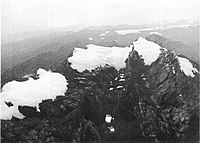 Ice cap at top of Puncak Jaya in Papua (1972).
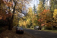 Autumn in the Blue Mountains, New South Wales.
 A tropical rainforest in Papua New Guinea.
 Monsoonal squall in Darwin.
 A billabong in the Kakadu National Park, Northern Territory. The monsoon climate of northern Australia is hot and humid in summer.
 Snow in Jindabyne, New South Wales, a town in the Snowy Mountains.
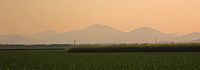 Grassland in Queensland with mountains in background.
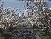 Spring in the apple orchards of Tasmania.


.svg)


_(Tasmania)_-_(Frank_Hurley)_(9711313115).jpg)

.jpg)


 Kurulu Village War Chief at Baliem Valley in New Guinea
![Didgeridoo player Ŋalkan Munuŋgurr performing with East Journey[165]](https://upload.wikimedia.org/wikipedia/commons/thumb/e/e7/Didgeridoo_%28Imagicity_1070%29.jpg/200px-Didgeridoo_%28Imagicity_1070%29.jpg)

![Didgeridoo player Ŋalkan Munuŋgurr performing with East Journey[165]](/info/en/?search=File:Didgeridoo_(Imagicity_1070).jpg)

 Media related to
Australia (continent) at Wikimedia Commons
Media related to
Australia (continent) at Wikimedia Commons


