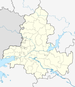
1st Rossoshinskiy
1-й Россошинский | |
|---|---|
Khutor | |
| Coordinates: 46°40′52″N 40°20′28″E / 46.681111°N 40.341111°E | |
| Country | Russia |
| Region | Rostov Oblast |
| District | Zernogradsky District |
| Time zone | UTC+03:00 |
1st Rossoshinskiy ( Russian: 1-й Россошинский) is a rural locality (a khutor) and the administrative center of Rossoshinskoye Rural Settlement of Zernogradsky District, Russia. The population was 911 as of 2010. [1]
Geography
The khutor is located on the Sredny Elbuzd River, 18 km from Zernograd.
Streets
Geography
1st Rossoshinskiy is located 35 km south of Zernograd (the district's administrative centre) by road. Krayny is the nearest rural locality. [4]
References
- ^ Россошинское сельское поселение на сайте территориальной избирательной комиссии Зерноградского района
- ^ Центр Регистрации и Сопровождения Бизнеса - www.regfile.ru. "1-й Россошинский х - Зерноградский р-н, состав: улицы, почтовые индексы, ОКТМО, ОКАТО | ФИАС". ifias.ru. Retrieved 2018-08-07.
- ^ "1-й Россошинский (Ростовская область)". bankgorodov.ru. Retrieved 2018-08-07.
- ^ Расстояние от 1-я Россошинского до Зернограда
External links
1st Rossoshinskiy
1-й Россошинский | |
|---|---|
Khutor | |
| Coordinates: 46°40′52″N 40°20′28″E / 46.681111°N 40.341111°E | |
| Country | Russia |
| Region | Rostov Oblast |
| District | Zernogradsky District |
| Time zone | UTC+03:00 |
1st Rossoshinskiy ( Russian: 1-й Россошинский) is a rural locality (a khutor) and the administrative center of Rossoshinskoye Rural Settlement of Zernogradsky District, Russia. The population was 911 as of 2010. [1]
Geography
The khutor is located on the Sredny Elbuzd River, 18 km from Zernograd.
Streets
Geography
1st Rossoshinskiy is located 35 km south of Zernograd (the district's administrative centre) by road. Krayny is the nearest rural locality. [4]
References
- ^ Россошинское сельское поселение на сайте территориальной избирательной комиссии Зерноградского района
- ^ Центр Регистрации и Сопровождения Бизнеса - www.regfile.ru. "1-й Россошинский х - Зерноградский р-н, состав: улицы, почтовые индексы, ОКТМО, ОКАТО | ФИАС". ifias.ru. Retrieved 2018-08-07.
- ^ "1-й Россошинский (Ростовская область)". bankgorodov.ru. Retrieved 2018-08-07.
- ^ Расстояние от 1-я Россошинского до Зернограда

